
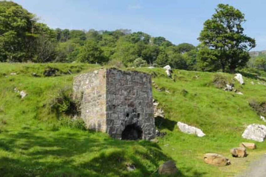
Murlough Bay Limekiln has a flue with a view!
The Murlough Bay Limekiln was probably active from the 1700s to the 1940s, and most particularly during the 1800s.
Coal from the Ballycastle coal seam and limestone were mined around Murlough Bay. The local geology is typical of the Antrim topography with basalt overlaying sandstone and limestone which made the production of lime popular along this coast.
The limekilns here would have processed limestone quarried from the cliffs above, that would have been burned together with the locally mined coal from the Ballycastle coal seam. The product was utilised for fertiliser or in mortar and occasionally as limewash, which was believed to have been used to whiten the buildings of Cushendun.
The kiln is a tall (almost vertical) square planned design. It is constructed of stone blocks, probably sandstone, in a lime mortar.
The limekiln measures 4.65m tall and 4.1m wide at its base, tapering to 3.84m at its top.
It has a 1.9m in diameter flue, centrally located within the square design.
At the draw-hole there is distinctive triple arch and directly above the archway there are two quite large vents cut into the outer casing.
The top of the flue is sealed with a removable iron grille, reached by a steep path from the roadway.
There are also ruins of a cottage behind the lime kiln, possibly occupied by the lime-burner and his family.
One unusual feature of this particular limekiln is the stone lean-to built at one side. This may have been used to store fuel or indeed the limestone itself and may also have offered shelter from the elements in this exposed bay.
Along the paths are scattered numerous small fragments of limestone, some evidently burnt. There is a significant amount of limestone/chalk in the immediate area and the southern end of the Ballycastle coal seam is also nearby.
Since this area is perfect for walking, try and locate the small car park at the hairpin bend. From here you can follow an ‘Industrial Trail’. This route takes you to the old coalmines at the foot of the cliff where a sure-footed explorer can find at least 3 entrances to the coal mines. You can then continues along the shoreline and back to the car park or you can venture a little further southwards to examine the remains of another limekiln!
Murlough Bay, County Down, Northern Ireland.
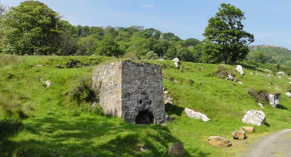